Story painting
The Story of a Painting by August W. van Voorden (1881-1921)
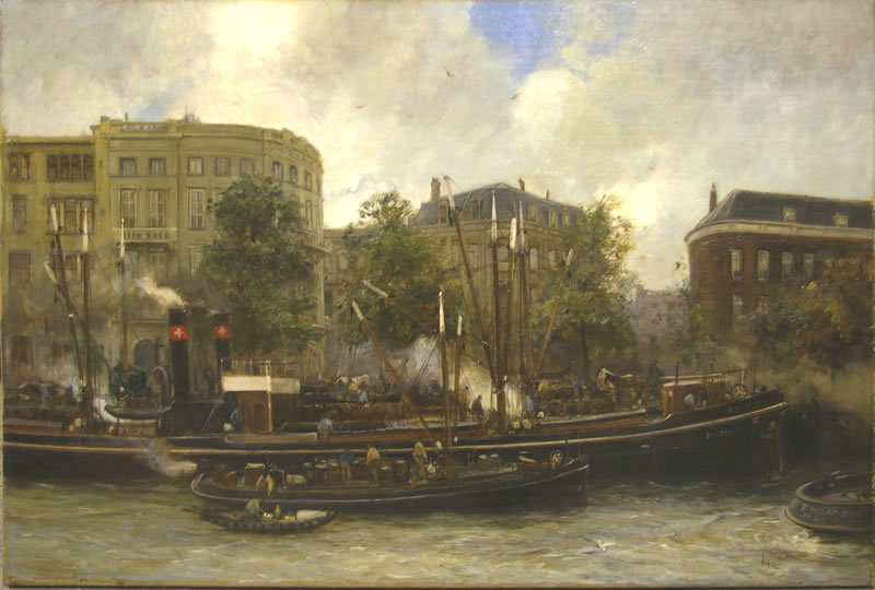
The painting of Van Voorden.
From my parents I inherited (2010) a painting that has been in the Kolff Family from its creation.
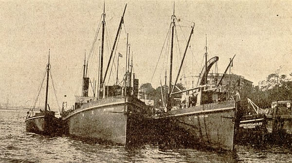
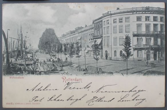
I think it was commissioned by the company Goudzwaard & Kolff, of which my grandfather was the owner. The Helvetia ships on the painting are part of that company. It was painted by August W. van Voorden. The painting depicts some of the ‘Helvetia’ ships at the quay of Willemsplein.
The Willemsplein is part of the ‘Nieuwe Werk‘ area at the centre of Rotterdam.
Rotterdam was bombed in May 1940 and the bombs destroyed the entire city centre; a fire blaze continued for several days in Eastern direction.
As can be seen (below, right) the bombs destroyed only part of the Nieuwe Werk, but almost all of what can be seen in the painting.
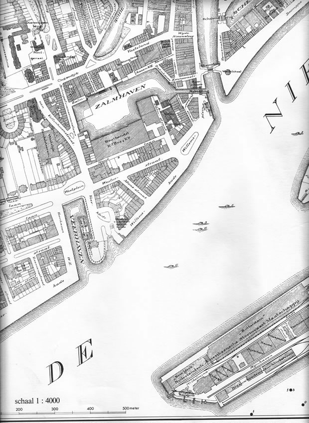
Above: Map of area (1924).
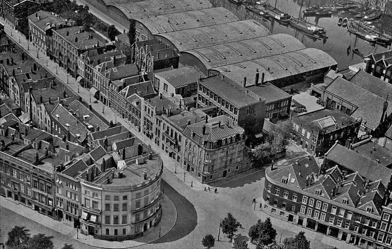
Areal view of same location (around 1930), after I found this image I was able to find the location of the painting.
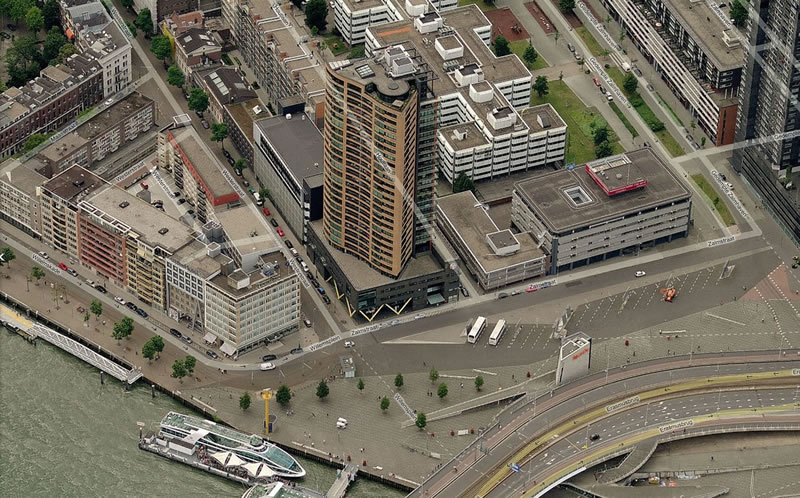
Below: the current situation.
My mother always told me the painting showed the ‘Boompjes’ quay, but this was not correct.
It took me quite a while to find an image of the location of the painting and I was very happy when i found this image (here at left).
After that I knew where the painting is located. The buildings show parts of Willemskade and Willemsplein, with a view into Westerstraat and Zalmstraat and even Houtlaan.
The map at right shows the devastation (darker colour) the bombs and the fire left behind. At right a part of the map is shown (the Southwestern part of the centre) of a larger map. As one can see the three blocks were unfortunately just within the bombing range (click on the map for the total range of the devastation). The streets depicted in the painting all exist today, but the buildings are new. The Zalmhaven was been filled in in 1991.
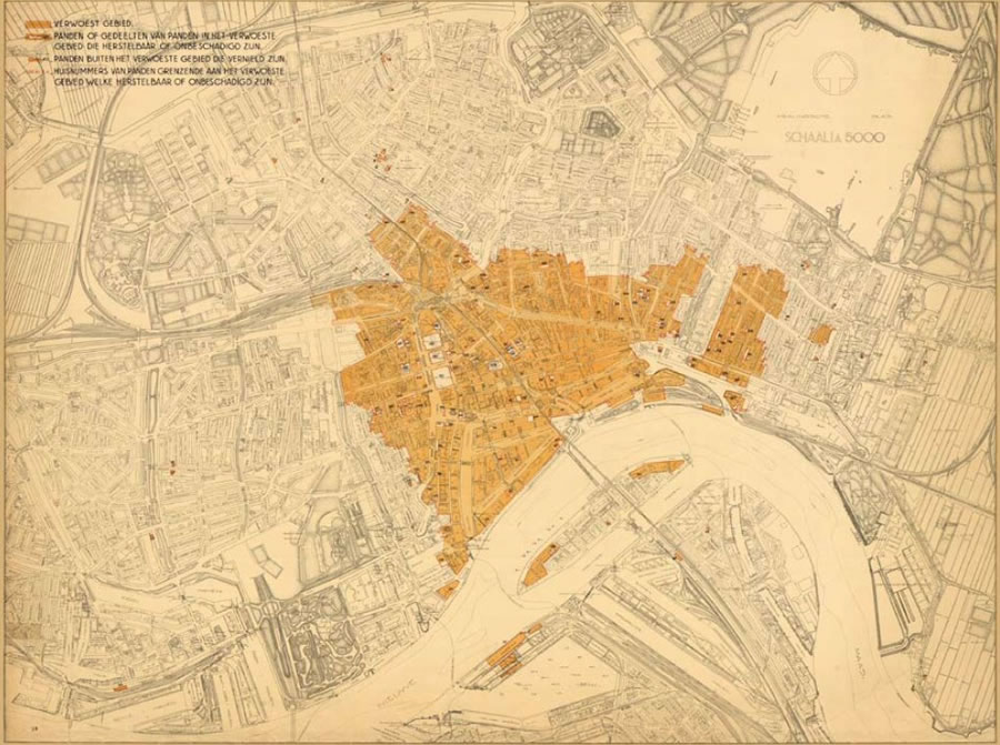
Below: Map of devastation.
On the painting, in one of the buildings behind the Helvetia ships, the offices of my grandfather were located, to be precize on the address Willemskade 14B. In the telephone directory of 1915, these offices are listed on the address: Pelikaanstraat 25b, but the recently placed adresboeken van het Archief Rotterdam helped me on dating the painting better: the move from Pelikaanstraat to Willemskade must have been in 1917 or 1918.
The Google Map at right here shows the current situation of which an areal photo can also be seen at left here.
If you want to see the situation of the area on a larger scale: open the enlargement (new screen).
The block of houses from Zalmstraat towards the right was never rebuilt after the bombardment because of the need of more space for traffic. The buildings there and some streets, such as Pelikaanstraat, now form part of an enlarged Willemsplein.
Thanks to the adresboeken van het Archief Rotterdam I could define the years the painting was created better:
Van Voorden died, rather sudden, in 1921; the office mopved to Willemskade in 1917 or 1918; so the painting must have been created somewhere between 1917 and 1921.
If one looks at the devastation in that area it is clear that most of the buildings could never be rebuilt.
Pre-WWII Rotterdam had huge traffic problems. The destroyed city centre enabled larger throughfares to be constructed. Willemsplein was enlarged. Since 1996 the Erasmusbrug leads across part of the square.
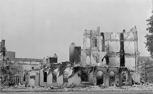
Above: Destroyed buildings Willemsplein/Willemskade.
I would like to elaborate more on the painting, the Willemsplein area before and after WWII.
An article on the painting has appeared in the 2011 issue of De Colve.
On this page I will include new information, such as I did in November 2011 on the adresboeken van het Archief Rotterdam – information I recieved from a very friendly lady, who sent me this purely out of interest after she had read these pages.
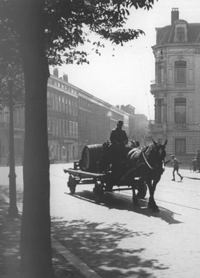
At right the Pelikaanstraat (just outside of the painting), some weeks after the devastation. It became part of the enlarged Willemsplein. This is the street where my grandfather had his offices at least until 1915. Above that an image of the destoyed building so prominently shown in the painting, at the left.